5.0
٣١ ألفتنزيل
1.45 ميجابايتالحجم
موقّع وموثوق
لقطات الشاشة
عن التطبيق
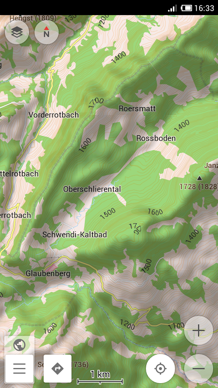
This plugin provides contour lines and hillshade which can be displayed in OsmAnd's offline maps.
* To download hillshade and contour lines map: Manage map files → choose the country you need → Hillshade/Contour Lines
* To enable hillshade layer online maps plugin should be enabled and hillshade should be selected as underlay layer
* Latest update: download functionality is fixed (New OsmAnd is required) *
The global data (between 70 degrees north and 70 degrees south) is based on measurements by SRTM (Shuttle Radar Topography Mission) and ASTER (Advanced Spaceborne Thermal Emission and Reflection Radiometer), an imaging instrument onboard Terra, the flagship satellite of NASA's Earth Observing System. ASTER is a cooperative effort between NASA, Japan's Ministry of Economy, Trade and Industry (METI), and Japan Space Systems (J-spacesystems).
</br></br>
معلومات إضافية
تاريخ التحديث
2022-03-20الإصدار
1.0الحجم
1.45 ميجابايتالمطور
Daniel Gdanielg0805@gmail.com
تصنيف المحتوى
Everyoneالحزمة
net.osmand.srtmPlugin.paidالتوقيع (MD5)
4b82e3fe7fb23da73dd84f3ec8ea0f5eالمزيد من Daniel G
موصى به لك
MakeMyTrip-Flight Hotel Bus Cab IRCTC Rail Booking
com.makemytrip
١٠٠ مليون تنزيل
28.64 ميجابايت حجم